

Harare starts GIS integration for prepaid water meters in Ward 16

Harare starts GIS integration for prepaid water meters in Ward 16
For all the News from Mashonaland Central, Join One of Our Groups
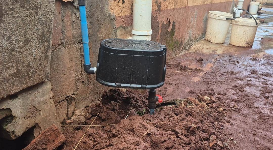
The City of Harare has begun integrating prepaid water meters installed across different suburbs into its Geographic Information System (GIS) database, an exercise council says is intended to strengthen water management and billing.
In a notice issued to Ward 16 residents, Ward 16 councillor Denford Ngadziore said the programme starts today and will link prepaid meters to the city’s GIS records.
“The purpose of the exercise is to connect the prepaid water meters to the Geographic Information System (GIS) database,” Cllr Ngadziore said.
He called on residents to assist municipal teams during the exercise. “Residents are kindly requested to cooperate with the City of Harare team during this exercise,” he said.
Ngadziore also advised residents to verify the identity of staff on the ground, saying those involved will have official identification. “All officials involved will carry a valid City of Harare identity card for identification purposes,” he said.
According to the city’s notice, the GIS integration is expected to improve monitoring and management of prepaid water meter infrastructure, while enhancing the accuracy of customer information and supporting service delivery.
Although the exercise is taking place in Harare, local authorities and residents in Mashonaland Central often follow developments in municipal water technologies closely, as councils in towns such as Bindura continue to face pressure to improve billing systems, reduce water losses and strengthen infrastructure planning.





Mundubile seeks new party route as Hichilema eyes second term
Mundubile seeks new party route as Hichilema eyes second term For all the News from Mashon…

Baradzanwa Cultural Village Emerges as a Premier New Year Tourism Destination in Mazowe
For all the News from Mashonaland Central, Join One of Our Groups Multitudes of …